

Industries & Working Sectors
Here are some applications we service:

Aerial Photogrammetry
From quarries and mines to road/rail, buildings and bridges, clients greatly reduce field time and overall surveying time while maintaining a high degree of survey accuracy. Achieve cm-grade, absolute accuracy (RMS) down to 2 cm on the vertical (z) axis.
Increase terrain measurement density and redundancy, with ground sampling distances to 0.5cm/pixel. Export precise bare earth models, digital elevation and surface models, orthomosaics and 3D models as final deliverables in CAD and a multitude of GIS software. Share your results cross-functionally with other teams and colleagues, with fully annotatable and manipulable data.

Aerial LiDAR & Remote Sensing
LiDAR shines in situations where photogrammetry doesn’t. It also provides extremely precise accuracies (down to 1.5cm on z-axis) even in remote locations.* A single scan yields a multitude of valuable data, such as power line swaying limits, line sagging, vegetation encroachment near assets, and more.
Scanning heavily forested environments with LiDAR allows us to collect enough ground data to process topographic models, bare earth models through brush & more. Other usages include forest inventory & resource management, archaeology, power line management, among others.
Air Quality Monitoring & Emissions Detection
Whether it’s monitoring LELs (lower explosive limits) of gases at an oil refinery or identifying VOCs (volatile organic compounds) at a landfill, our drones are equipped with corresponding sensors to make this flying laboratory a reality. We’re able to sense particulates of PM 1, PM 2.5, PM 4 & PM 10 while simultaneously collecting other data such as temperature, humidity, barometric pressure, high-accuracy GPS recording and high accuracy altitude measurements. Our cutting-edge payloads can be equipped with 4 electrochemical sensors, 1 NDIR sensor (CO2 etc), 1 PID sensor (VOC) + 3 PM sensors. Contact us to learn more!

Aggregates / Mining
With drone-based surveying & mapping, mining clients have optimized layouts of their mining facilities and infrastructure, thanks to regularly updated basemaps. Permitting and application processes are more streamlined thanks to high-resolution maps and accurate 3D models of sites, shareable with permitting authorities. Data of sites spanning even thousands of acres is collected in a fraction of the time versus traditional methodologies.
With state-of-the-art drone and post-processing softwares, areas, volumes and other measurements are identified with accuracy to within 3 cm (No Ground Control) and down to within 2 cm (with Ground Control). With bulk density factors of material types, net tonnage is quickly calculated to ensure inventory control measures have been met. Collected data is also exportable to a multitude of outputs and many file types.

Ground Penetrating Radar (GPR)
What’s beneath your feet just became a lot more discoverable. We leverage GPR as a non-intrusive means of analyzing subsurface variances, with added benefits of doing so with drones. They allow us to mobilize this equipment faster, cover more terrain faster, explore hard-to-reach areas and more.
We apply GPR to a variety of environments including sub-terrestrial infrastructure inspections and mapping, underground foreign object identification, and bathymetric data capture; even through ice and snow. Click/tap the image on the right to contact us about our GPR capabilities.

Confined Space
Our drones go into places where people shouldn’t need to go. We quickly identify cracking, corrosion and other asset anomalies, allowing for detailed integrity assessment of often dangerous conditions. Our operational expertise allows us to recreate your inspection environment as a 3D model, exportable in various file types for use in a multitude of CAD softwares.
Worker safety is completely mitigated thanks to carrying out the operation from safe distances and locations. Inspection and maintenance costs are greatly reduced since traditional project costs are eliminated, including scaffolding, boom lifts, hazmat gear, worker insurance costs and more.

Construction / BIM
Increase workflow to meet project deadlines while saving money. Clients track work progress with accurate, intuitive project data and insights which include a multitude of measurement data and fully annotatable design models. Our technology also makes a profound impact on BIM verification, automatic verification of as-built data, progress/project documentation and more.

EMS / Search & Rescue
Our aerial experience and technology has allowed for valuable partnerships with search & rescue teams everywhere. First responders, government bodies and private firms expedite their search efforts with increased coverage of vast terrain much quicker, regardless of weather conditions.
We’re able to relay critical information such as GPS and physical locations while identifying hazards and obstacles for relief crews, in real-time. Interchangeable payloads mean a variety of tools (thermal & HD imagery, payload dropping capabilities) are readily accessible when help arrives.

Energy
Conduct shade analysis for solar panel installations, create design layouts, and plan projects with direct exporting to CAD and other platforms. Locate hot spots and faulty cells, structural fractures and other abnormalities; all auto-imported into proprietary risk-assessment reporting.
Infrared and HD 180x zoom image tagging yields high accuracy and real-time analysis, even before returning to the office. Pre-maintenance inspections identify premature issues, minimizing costs down the road.
Thermal mapping allows for high accuracy photogrammetric surveys of proposed/existing infrastructure showing heat anomalies.
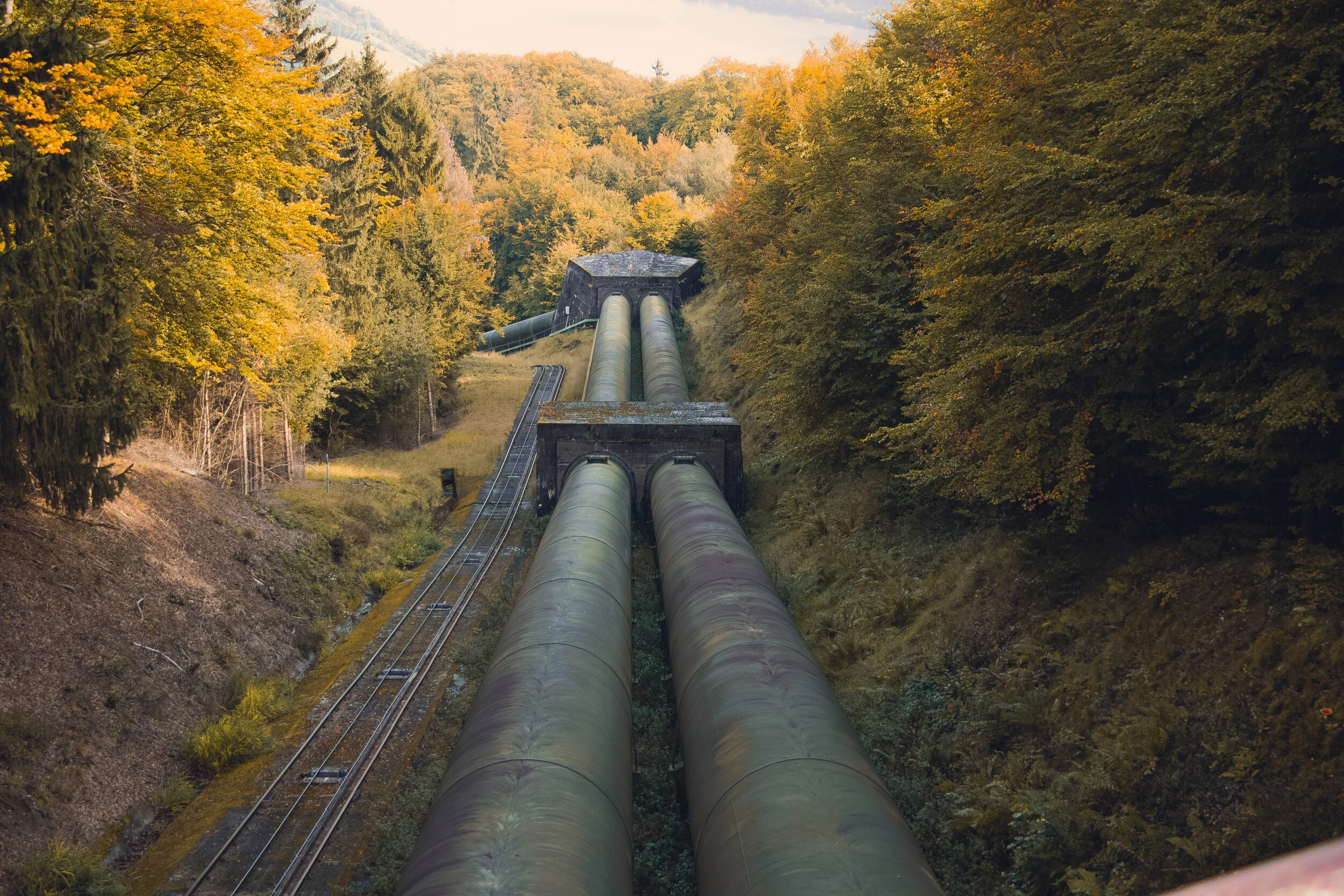
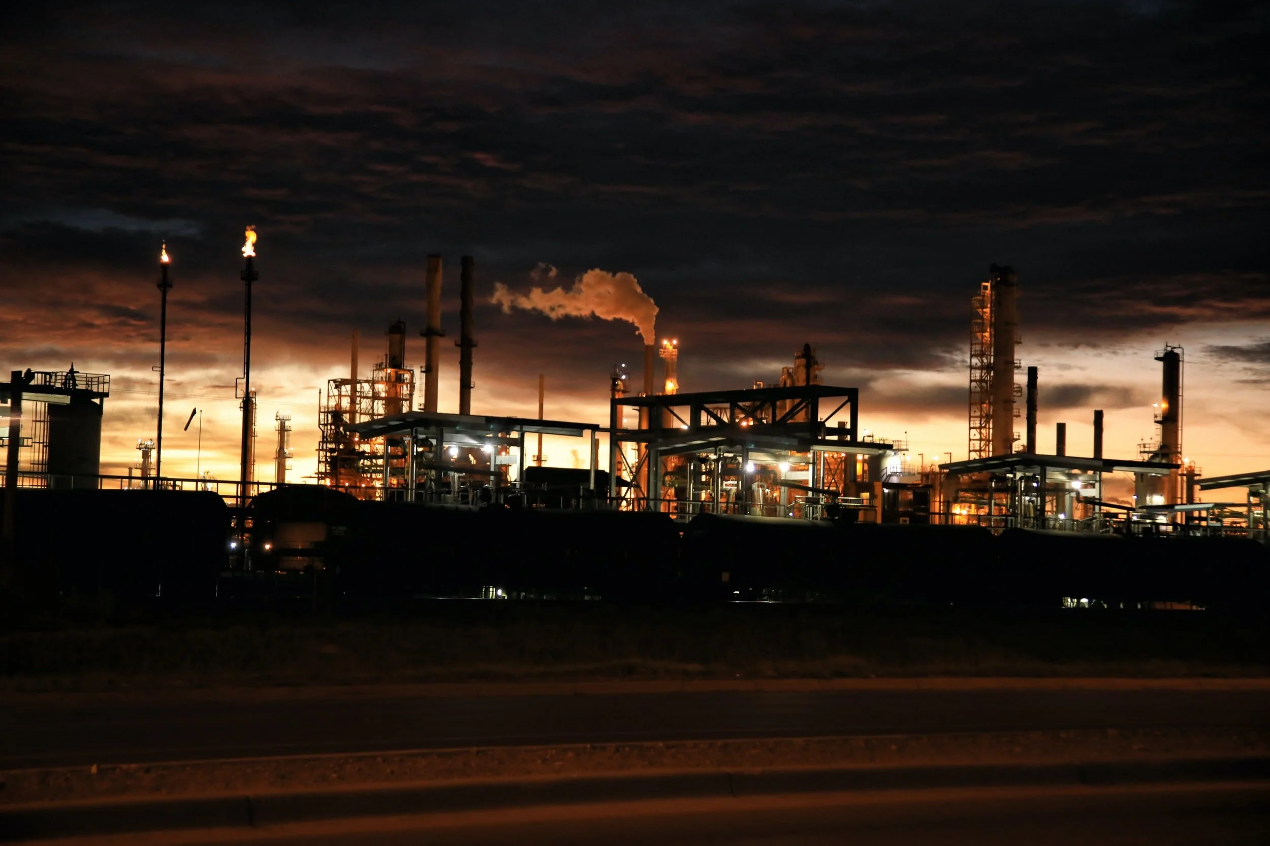
Oil & Gas
Our external and confined-space drone services allow customers to simultaneously increase worker safety, reduce inspection costs and minimize asset down time. We partner with ticketed inspectors (API, CWB, UT level-3 and more) to provide faster and more thorough visual inspections that greatly assist in maintenance planning. We further enhance confined-space inspection efforts with LiDAR, photogrammetry and 3D modelling services, allowing customers to annotate, measure manipulate asset features in various CAD programs.
We revolutionize how companies inspect their infrastructure and partner with ticketed inspectors, internationally. Applications include asset decommissioning/rehabilitation and inspections of chimneys/flare stacks, offshore rigs, jetties, refineries and storage tanks. Tap on the image to chat with an expert.

Utilities & Critical Infrastructure
We identify irregularities quicker & safer, providing you with deeper & more actionable insights than anyone else. Period.
Performing AI-based inspections means you receive geo-referenced risk-assessment reporting of your entire infrastructure & components based on machine vision AI, predictive analytics, machine learning & computer vision algorithms to identify risks before they are critical.
Reduce energy costs with hi-res and thermal/IR imaging of insulation inefficiencies, with further sub-surface data collection such as RF leakage identification.

Aerial Magnetometry
Retrofitting magnetometry on our drone-based platforms allow us to more quickly & efficiently measure strength & direction of magnetism to find anomalies. It adds value across a number of sectors including archaeology, mining/exploration, environmental engineering, geology & Unexploded Ordinance (UXO) identification.
Collecting samples every 1 cm at drone flight speeds of 10 m/s means substantial coverage areas in often cumbersome terrain, such as protected wetlands & heavily vegetated regions. Aerial magnetometry is yet another example of an existing technology made even better through drone integration.
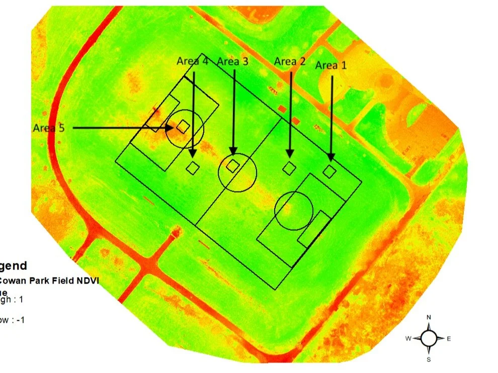
NDVI & Precision Agriculture
Realize improved crop yields thanks to efficient drone-based spraying. Our equipment covers vast land sizes in a fraction of the time versus traditional spraying techniques.
Agriculture, sports recreation & golf course-based clients manage irrigation efforts by adding plant health monitoring services to thermal/IR, greatly reducing operational costs.
Leveraging numerous agri-specific algorithms, we’re even able to perform crop counting and gather other yield data. Combine these offerings with available soil-sampling offerings, you have complete end-to-end crop analysis and reporting solutions.

Production & Marketing
Gather content from innovative perspectives, previously reserved for costly, dangerous helicopter operations. Tell a more effective story by allowing your audience to engage with you in a new way.
With live-streaming capabilities to a multitude of social media platforms, your brand can better attract attention on a global scale.
Combine aerial content with our available in-house ground photo/video and pre/post-production services, for completely turnkey marketing and advertising solutions.

Real Estate
Drone usage in real estate allows for an entirely new story to be told to buyers/sellers as well as real estate agents/brokers. Showcase entirely new vantage points of homes and properties. See an entire lot or acreage in one shot, giving prospective buyers a better idea of the property area, features and home size.
Market the property location compared to surrounding points of interest and highlight the area’s unique geography, previously unseen. Clients also appreciate perspectives that showcase nearby schools, shopping, parks and roadways, all from the proximity of their home-to-be.

Small to Large Venues
Show off venue size and scope, locational features, landmarks, geography and unique event features in immersive, stunning resolution up to 6K CinemaDNG at 60fps. With Hollywood-level image and video processing technology, your memorable event moments are remembered like never before.
Drone technology also adds value to security and logistical efforts. Better monitor venue security with aerial scanning of perimeters and IR sensing. Increase logistical preparation and event space usage with property mapping and measuring.

Telecommunications
Safety first. Always. Exponentially reduce this concern with respect to harmful electromagnetic waves, live circuit exposure, open flames and working at heights. As a result of this mitigation, zero shutdown times also mean huge cost savings from live inspection.
Collect thermal, IR, RF and 180x zoom hi-res data simultaneously and unattainable from climbing alone. Adding real-time reporting and consulting from a nearby onsite safe location, clients immediately understand asset health for immediate maintenance planning.
Still unsure if we can help? Yes or no, we’ll let you know either way.